
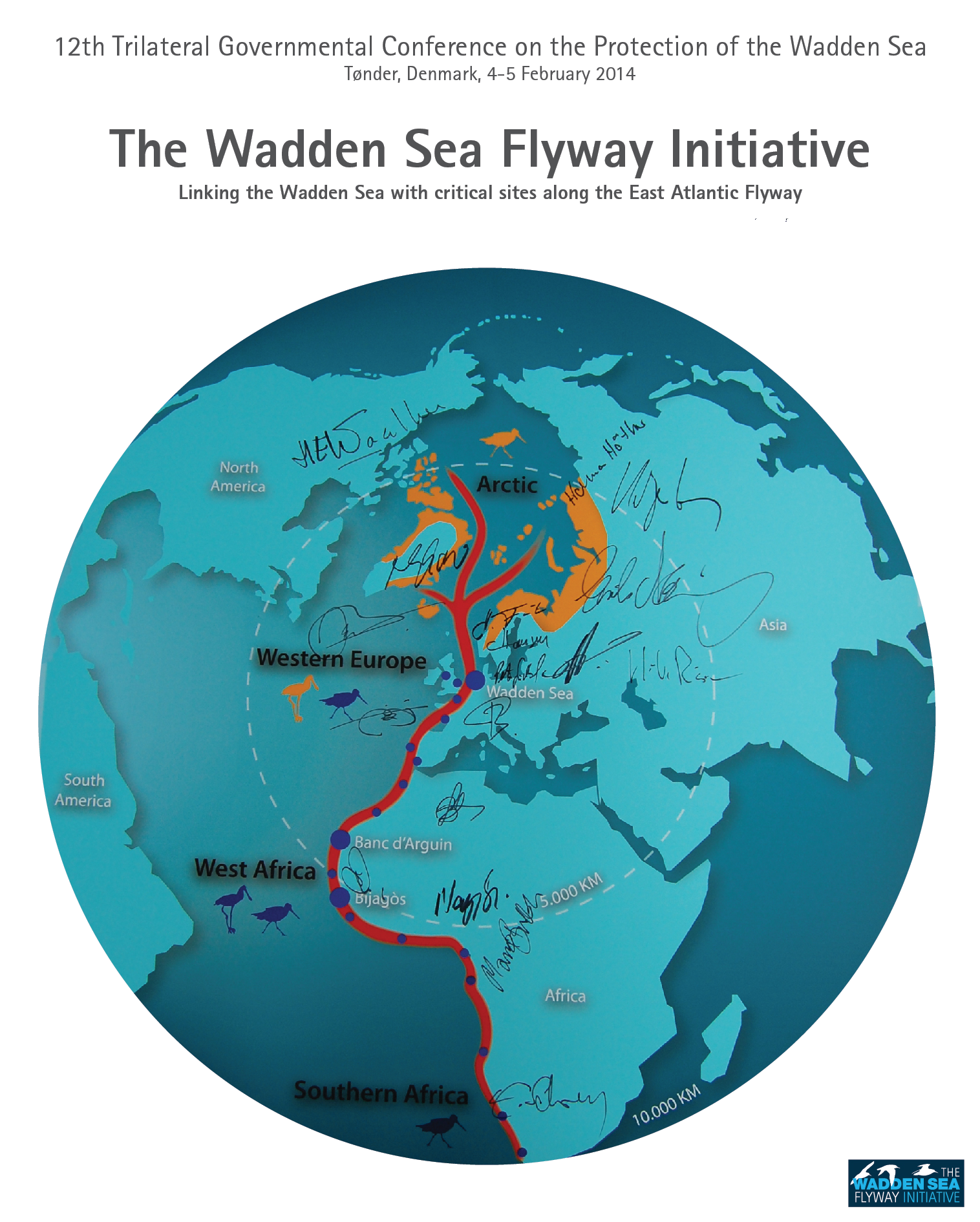
The Wadden Sea is a vast coastal wetland comprising of tidal flats, islands, salt marshes and other habitats, stretching over 500km along the North Sea coast of the Netherlands, Germany, and Denmark. At almost 11.500 km2 in extent, it is one of the largest tidal wetlands in the world. The high quantity and quality of food, found in the mudflats and saltmarshes, make it an important breeding, moulting and wintering area for migratory birds along the East Atlantic Flyway. About 10 million waterbirds stay or visit the Wadden Sea each year and according to the Ramsar Convention, it is essential for the existence of at least 52 populations of 41 migratory waterbird species. Due to the area's Outstanding Universal Value for biodiversity, especially for migratory birds, the Wadden Sea was declared a World Heritage Site in 2009, with the Danish part of the Wadden Sea being added in 2014.
At the request of the UNESCO, the Trilateral Wadden Sea Cooperation launched the Wadden Sea Flyway Initiative (WSFI) in 2012 in recognition of its responsibility for the survival of migratory birds on a global scale. The aim of the initiative is to strengthen cooperation on conservation, management and research activities between the three Wadden Sea states and other countries along the East Atlantic Flyway which play a significant role in conserving migratory waterbirds along this flyway.
At the 12th Trilateral Governmental Wadden Sea Conference in Tønders in 2014, 28 partners have signed a Declaration of Intent to help implementing the WSFI Flyway Vision.
In close collaboration with the partners, two programmes have been developed under the umbrella of the WSFI that aim to increase the knowledge about the issues faced by migratory birds along the East Atlantic Flyway and the local capacity for their conservation:
The objective is to provide timely and accurate data about the status of waterbird populations along the East Atlantic Flyway. Counts are being conducted annually at key sites, while simultaneous total counts in almost all countries take place every three years. The results provide information on changes in the status of flyway populations. Comparisons between trends in numbers at the flyway and the local level allow to identify of sites which are likely to positively (site trend > flyway trend) or negatively influence the flyway populations. Environmental monitoring of important bird areas helps to identify threats which may be responsible for declines in bird populations, thus providing information for effective management.
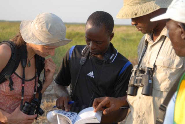
The aim is to intensify cooperation for the protection of waterbirds, with a special focus on capacity-building, improvement of area management, and sustainable development along the Atlantic coastline of Africa. Regional and local capacity building and training workshops, management plans, and educational materials, as well as concrete infrastructure developments like bird observatories or the provision of boats, form the basis to improve the management of habitats and conservation of migratory water birds along the African Atlantic coastline. Frequent exchange between local, regional, and international stakeholders along the flyway ensures that everyone can learn from each other and benefit from each other's expertise.